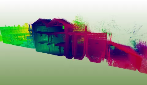
Our focus on innovation in digital technologies allows us to deliver speed, accuracy and 3D mapping
The use of innovative digital survey techniques is revolutionising the way we record our excavations, buildings and landscapes. These techniques are fast, extremely accurate and can provide records of archaeological remains in 3D.
The most notable of these techniques is photogrammetric mapping which uses photographs taken from a UAV (drone) to create accurate three-dimensional models of almost anything - standing stones, artefacts, historic buildings and whole landscapes. Other techniques for data capture include differential RTK GPS, 3D laser scanning, LiDAR and Total Station surveys. Our survey staff are highly trained, very experienced, and have full CAA (Civil Aviation Authority) licences to undertake commercial aerial work.
We also offer geophysical surveys, which we carry out in-house or commission external providers, particularly for larger-scale projects.
Our geomatics department provides unparalleled services in data collection and the use of GIS for heritage management, predictive modelling, and research-orientated applications. We can handle data from most systems currently available, and can work with legacy data or can provide data for bespoke systems if necessary.

