
A487 Caernarfon to Bontnewydd Bypass
A 10km road was constructed as a bypass around Caernarfon and Bontnewydd, in Gwynedd, North Wales. This was commissioned and funded by the Welsh Assembly. A Balfour Beatty and Jones Brothers joint venture constructed the road, with Oxford Archaeology acting as its archaeological contractor. The new road reduced congestion and pollution and improved safety for pedestrians and road users. It will provide a vital economic boost to the region by improving transport links between the Llyn Peninsula, Porthmadog, Bangor and the A55.
The road passes through a rural coastal landscape in the hinterland of Caernarfon, crossing four rivers that flow between the Snowdonia (Eryri) mountains to the south and the Menai straight, which separates the mainland from Isle of Anglesey (Ynys Môn). Some evaluative work had been undertaken previously, but, owing to issues with land access, further trial trenching was required. Additionally, the written scheme of investigation for the project required that most (33ha) of the footprint for the new road was stripped to an archaeological specification and was monitored for the presence of archaeology. This was successfully carried out within budget and without delay to the construction programme and led to the identification of 31 new archaeological sites. These dated from the Mesolithic to the post-medieval periods and greatly enhanced the archaeological knowledge of the region.
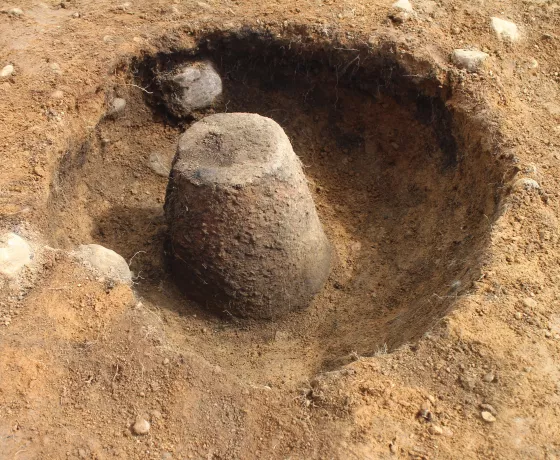
There was extensive evidence for prehistoric occupation, with several sites along the scheme providing evidence for Mesolithic hunter-gatherer camps. Similarly, pits and structural features, associated with pottery and flaked lithic tools, showed that Neolithic farmers also settled, or passed through, the area. Bronze Age pits and cremation burials clustered in key places and some 23 burnt mounds lay focused on the main rivers.
Caernarfon had been strategically significant in the Roman period, with the major auxiliary fort of Segontium being sited there and linked by road to Chester and Caerleon. This was garrisoned by troops (limitanei) who defended the region against Irish raiders. The new road passed through a well-preserved section of the main Roman road to Chester (Iter XI in the Antonine Itinery), allowing 123m of this to be exposed and characterised. There was also some evidence for Iron Age and Roman farming settlements.
Elsewhere, farmsteads were dated to the early medieval period, which, regionally, is very rare. Post-medieval field boundaries and enclosures were encountered in many places and would have denoted land tenure and helped manage livestock until recent times.
The post-excavation assessment has concluded, and a major programme of stratigraphic, artefactual and palaeobotanical assessment and radiocarbon assay has conclusively demonstrated the significance of the investigated sites and their potential for analysis. Analysis is expected to commence shortly and will be address the relevant research priorities identified in the Research Framework for the Archaeology of Wales. The results of this will be disseminated by publication and other media and will leave behind an important cultural legacy, a public benefit derived directly from the road’s construction.
-
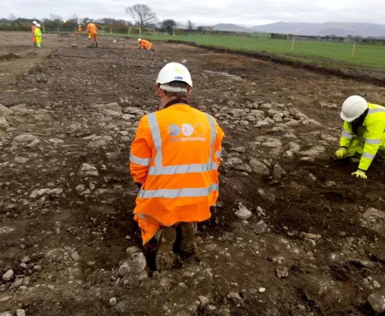 Archaeologists excavate the Roman road
 -
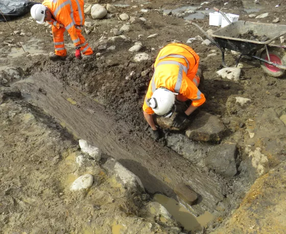
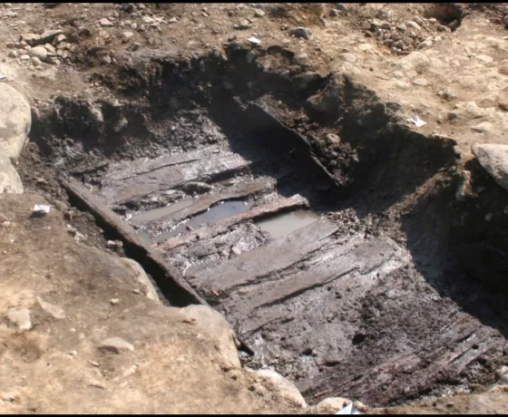 A Timber-lined burnt mound trough
 -
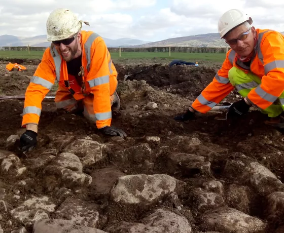
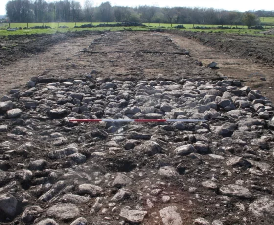 The Roman road
 -
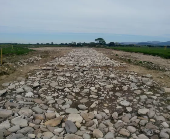 The Roman Road
 -
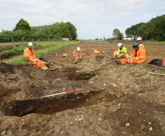 Archaeologists working at Caernarfon
 -
 Archaeologists excavate the Roman road
 -
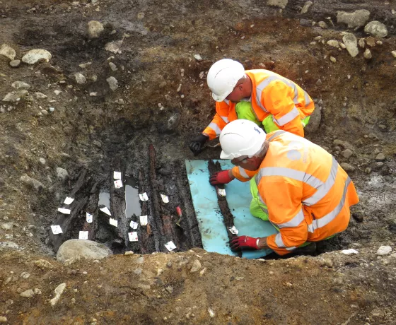 Archaeologists excavate timbers from the burnt-mound trough
 -
 Archaeologists excavating a large timber plank
 -
 A Bronze Age cremation urn