Oxford Archaeology undertook an archaeological excavation of an Iron Age settlement at Hook Norton Road, Sibford Ferris, Oxfordshire. The work was carried out on behalf of Gade Homes in consultation with Orion Heritage.
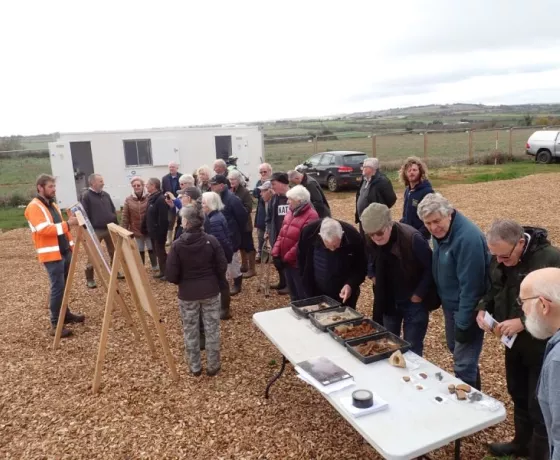
By clicking the links below you can find out more about the project, the people involved and what we hoped to find. As the project developed this page was updated on a weekly basis with information on the archaeological features exposed, the artefacts recovered and our understanding of the site.
Archaeological Desk-Based Assessment
In 2018, Orion Heritage undertook a desk-based investigation of the site. The document considers the archaeological potential of the site by reviewing the existing information available. This included a search of the Oxfordshire Historic Environment Record, and a review of historic mapping and aerial photographs.
The report concluded that based on the available information there was limited potential for archaeological remains of all periods to be present within the site. However, this was caveated with the fact that little previous archaeological investigation has been undertaken in the wider area limiting the level of data available for review. The report outlined that, in accordance with local planning policies, archaeological investigations would be required to confirm the absence or significance of any archaeological remains within the site.
You can read the full report here.
Geophysical Survey
The first stage of archaeological investigation was the completion of a geophysical survey. This is a non-intrusive technique that detects magnetic variation in the soils that can be interpreted to help determine the presence or absence of archaeological remains.
The survey, commissioned by Orion Heritage on behalf of Land and Partners South East Limited, was undertaken by Magnitude Surveys in 2019.
The survey identified geophysical anomalies indicate the remains of a large rectangular enclosure with and entranceway and internal alignments of pits, along with a separate D-shaped enclosure.
The full report produced by Magnitude Surveys is available here.
Trial Trench Evaluation
The potential archaeological features identified by the geophysical survey were investigated as part of a trial trench evaluation undertaken by Cotswold Archaeology in May 2019. The evaluation comprised the excavation of 15 trenches each measuring 30m long and 1.8m wide which were distributed across the site both targeting potential archaeological features identified by the geophysical survey and areas suggested to be devoid of remains.
The evaluation confirmed that archaeological remains are present within the site and that they are concentrated in the eastern half. The features identified comprised ditches forming enclosure systems and boundaries, along with several pits. The main focus of activity was an enclosure of mid to late Iron Age date with associated features indicative of domestic settlement activity. Limited evidence for Roman occupation, defined by an enclosure, was also identified. A third enclosure was also present but is it was not possible to establish a date during the evaluation.
You can read the full evaluation report from Cotswold Archaeology here.
Excavation and our works
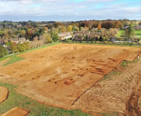
Based on the results of the geophysical survey and trial trench evaluation, an area measuring approximately 1.2ha, which encompasses the Iron Age and Roman enclosures, has been identified for further archaeological excavation. This is the work that Oxford Archaeology will be undertaking.
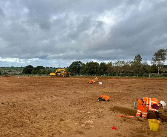
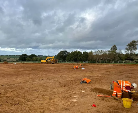
The first stage to be completed is the removal of current plough soil from across the area to expose the full extent of the underlying remains. This will be achieved using mechanical excavators, but the underlying archaeological remains will be excavated by hand. Throughout the project will be using GPS survey techniques to produced plans of the archaeological features. Once we are under way we will be able share these plans with you.
Through the excavation of the remains, the recovery of artefacts and environmental soil samples, we can develop an understanding of how the site would have functioned, the lives and activities the residents would have undertaken and details of the environment in which they lived. Eventually all the data collected during the fieldwork is assessed and detailed reports produced. During this process we not only aim to understand the site itself but consider the site in the wider landscape.
Details of the excavation area and the strategy to investigations are outlined in our method statement which can be read here.
Meet the team
Orion Heritage is a leading independent archaeological and built heritage planning consultancy providing advice to the private & public sector aimed at resolving the often conflicting demands of conservation while achieving profitable and sustainable developments.
The company prides itself on understanding our clients' businesses and projects and responds positively to their aims and objectives. In order to do this, we provide the following services:
John started his career in commercial archaeology in 2007 after completing his BA in Archaeology at the University of Nottingham. Since joining OA in 2009, John has worked on a variety of projects as a field archaeologist until progressing to his current role as Senior Project Manager. In his current role he oversees a wide portfolio of projects ranging from small scale evaluations and excavations to large infrastructure projects. Over his career John has worked across the south of England and East Anglia, and in his spare time is involved in research projects in Northumberland and Anglesey. He has experience with archaeology from all periods but has a particular interest in prehistory. John is a Member of the Chartered Institute for Archaeologist (MCIfA).
Paul is one of the most experienced Project Officers at Oxford Archaeology and has worked at the company for 35 years in total. He has been PO on a wide range of OA’s projects, including Ipswich Stoke Quay, East Kent Access Project, Fromelles 1st World War graves, Ferry-Bridge chariot burial, Bristol Finzel's Reach, Southampton French Quarter, Zeugma Turkey Rescue Project and Channel Tunnel Rail Link. In his role as PO he will direct the excavation on site on a day to day basis. He is Associate with Chartered Institute for Archaeologists (ACIfA).
Cathy is a Technical Director at Orion Heritage and heads up Orion’s Worcester office. She has over 25 years of experience in professional archaeology, sixteen of those in archaeological consultancy. Cathy has a particular specialism in strategic land promotions. She has a strong client-base in the West Midlands and is known for her pragmatic and commercially-aware advice. Cathy is a Member of Chartered Institute for Archaeology (MCIfA).