The survey works in 2022 had clearly shown changes in the last thirty years. However, it is one thing to view the Horse from images and drawings, it is another to dig into it and potentially damage archaeological stratigraphy. We needed to define an approach that minimised any damage but allowed us to proceed with confidence that we were really restoring the Horse and not just creating an idealised twenty first century image of it.
In 2023 we outlined and submitted proposals to Historic England to undertake preliminary investigations: a) to remove the turf and topsoil soil from around parts of the Horse to ‘ground test’ the results of the survey and b) to establish how much of earlier extents of the Horse were visible immediately beneath the turf. We knew from the 1990s investigations that below the modern topsoil the stratigraphic layering of earlier rammed chalk and eroded chalk-wash were complex and therefore not to be disturbed lightly. We decided to initially target the head and neck where those more significant changes could be seen. A team of volunteers and support from OA and the NT set to work.

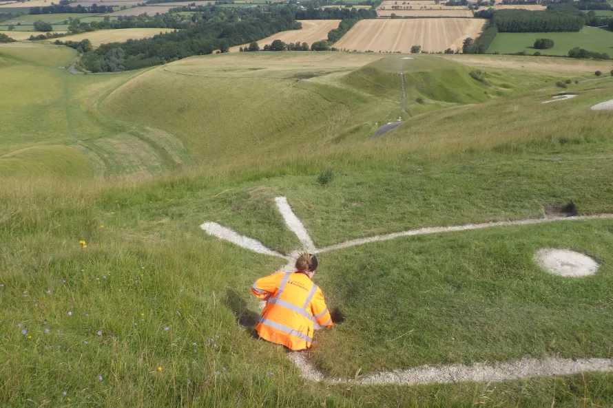
After a wet and miserable start on a typical Monday morning in July there was a rare occurrence of the old team of Miles & Palmer seen in digging action. The results from the six excavated slots were clear and demonstrated that yes, the buried Horse was in fact just beneath the topsoil. The chalk of the Horse revealed beneath the turf was ‘dome-shaped’ with its edges disappearing under soil layers different from and overlain by the topsoil; layers we did not have permission to remove. This was what we hoped – the more recent Horse, that had disappeared over the last thirty or so years, was still there and indications that perhaps wider extents were still buried. It would be too simplistic, perhaps, to relate the visible chalk beneath the turf to the extent of the 1989 survey, and the hidden wider extents reflecting the 1926 and 1937 surveys. Yet, the extents showing on the1989 survey matched closely.
The earlier twentieth century surveys showed a shifted position and thicker outlines than the newly exposed chalk. Looking closely at the ground and the topography, it is clear that this shift is a result of some ‘survey error’: probably inaccuracies in the manual terrestrial based surveys and also general error in the combination of all the surveys at this enlarged scale.
With these trenches open all parties met to review the results and agreed that after due consideration further proposals on how to proceed should be submitted with a view to doing more work in 2024. You cannot rush matters with such an esteemed equine of ancient lineage!
